Germany, Austria, Italy, Lichtenstein and Switzerland 2015 by William Bryan

After finishing up my sophomore year at school I flew over to Germany to meet up with my mom. The trip was meant to be for R&R after the long hard winter in Boston but it turned out to be 10 days packed with travel. We drove from Germany down through Austria, into Italy, and back up to Germany through Switzerland, Lichtenstein and Austria. In Italy we stayed in Lago di Garda, and in Milan.

Check out springtime in Europe below.

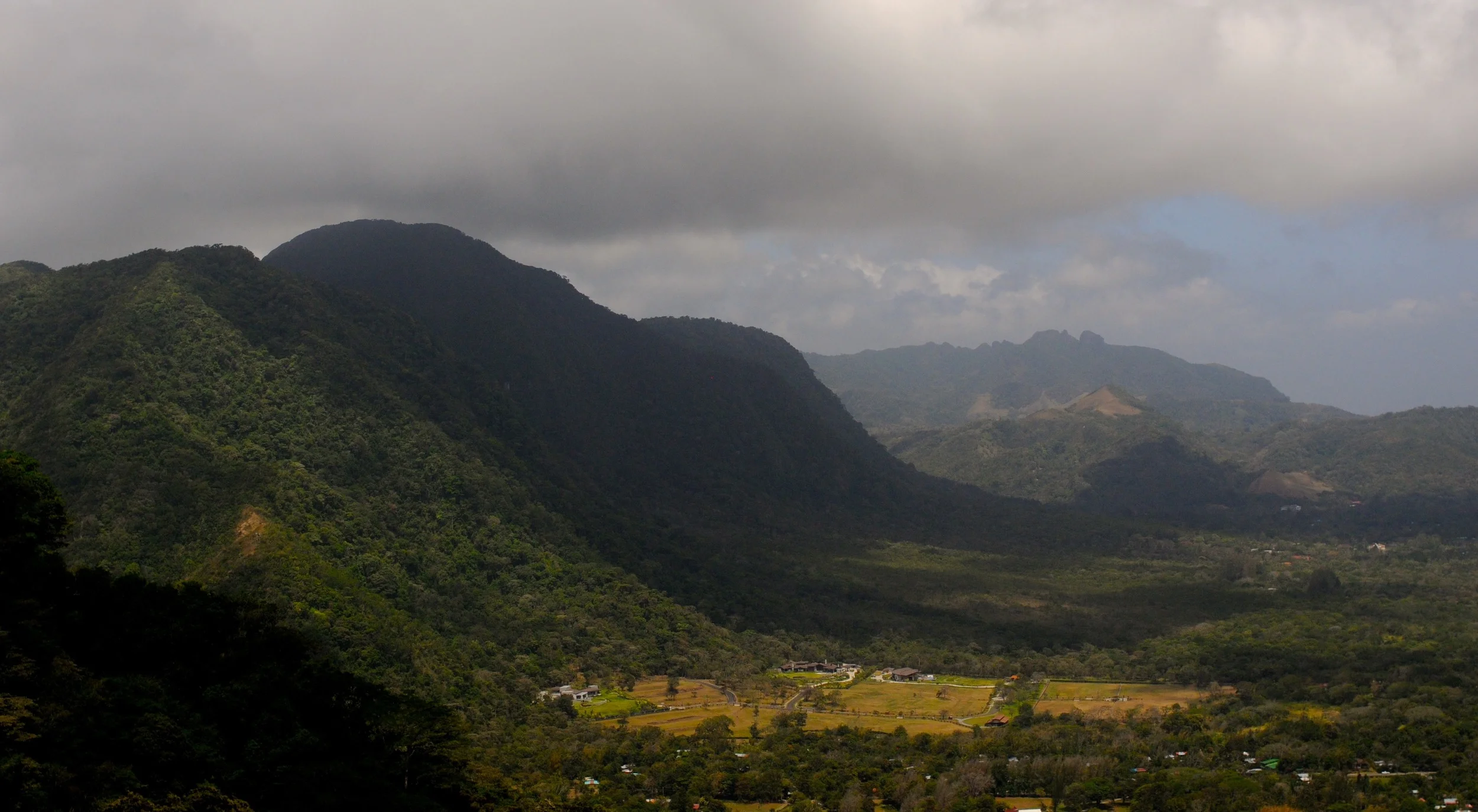
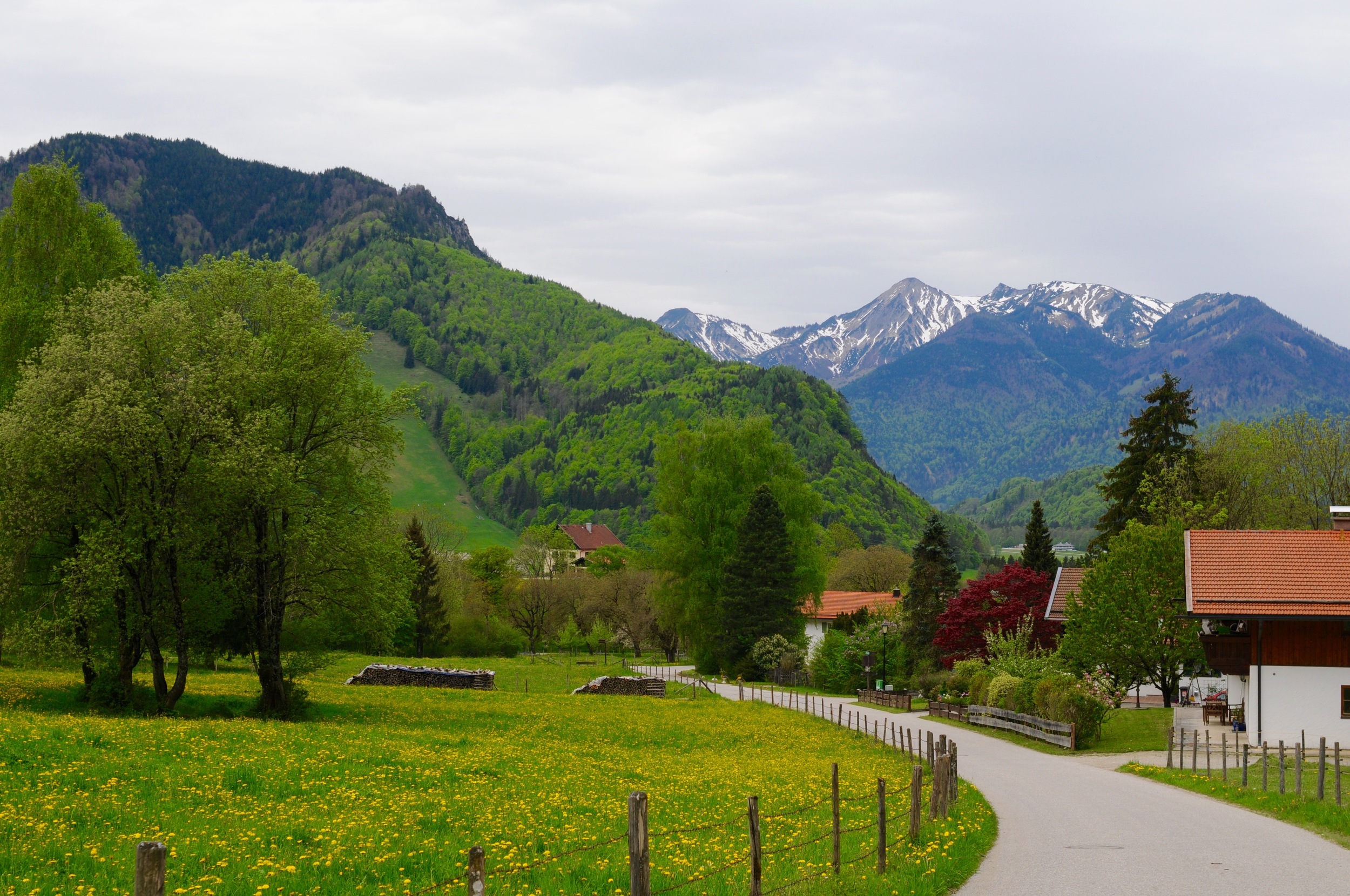
My home base in Germany – Unterwössen.

Same mountains in Unterwössen, different exposure.

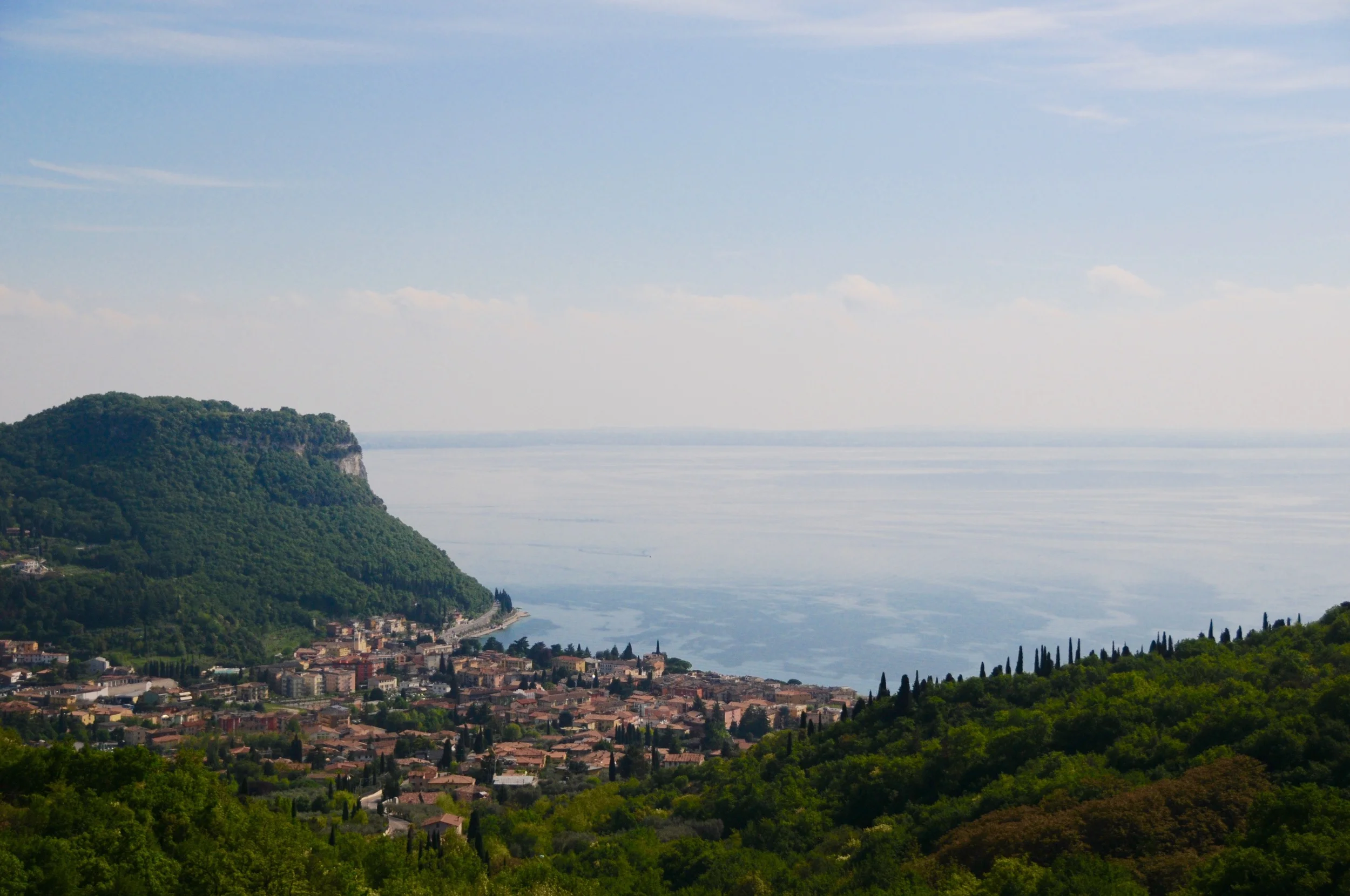
A view over looking Lago di Garda, the largest lake in Northern Italy’s lake region.

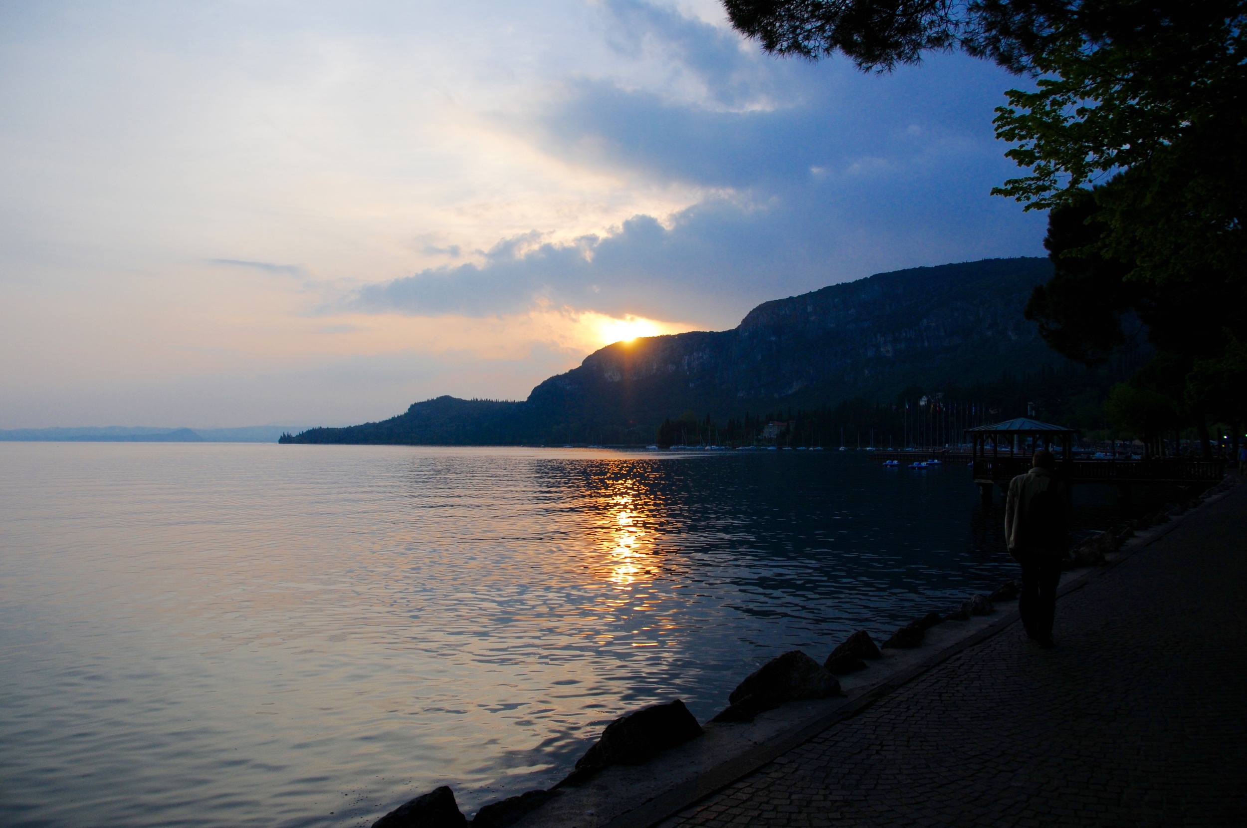
The edge of the lake. We took a ferry from here to another small town on the other side of the lake and explored for a day.

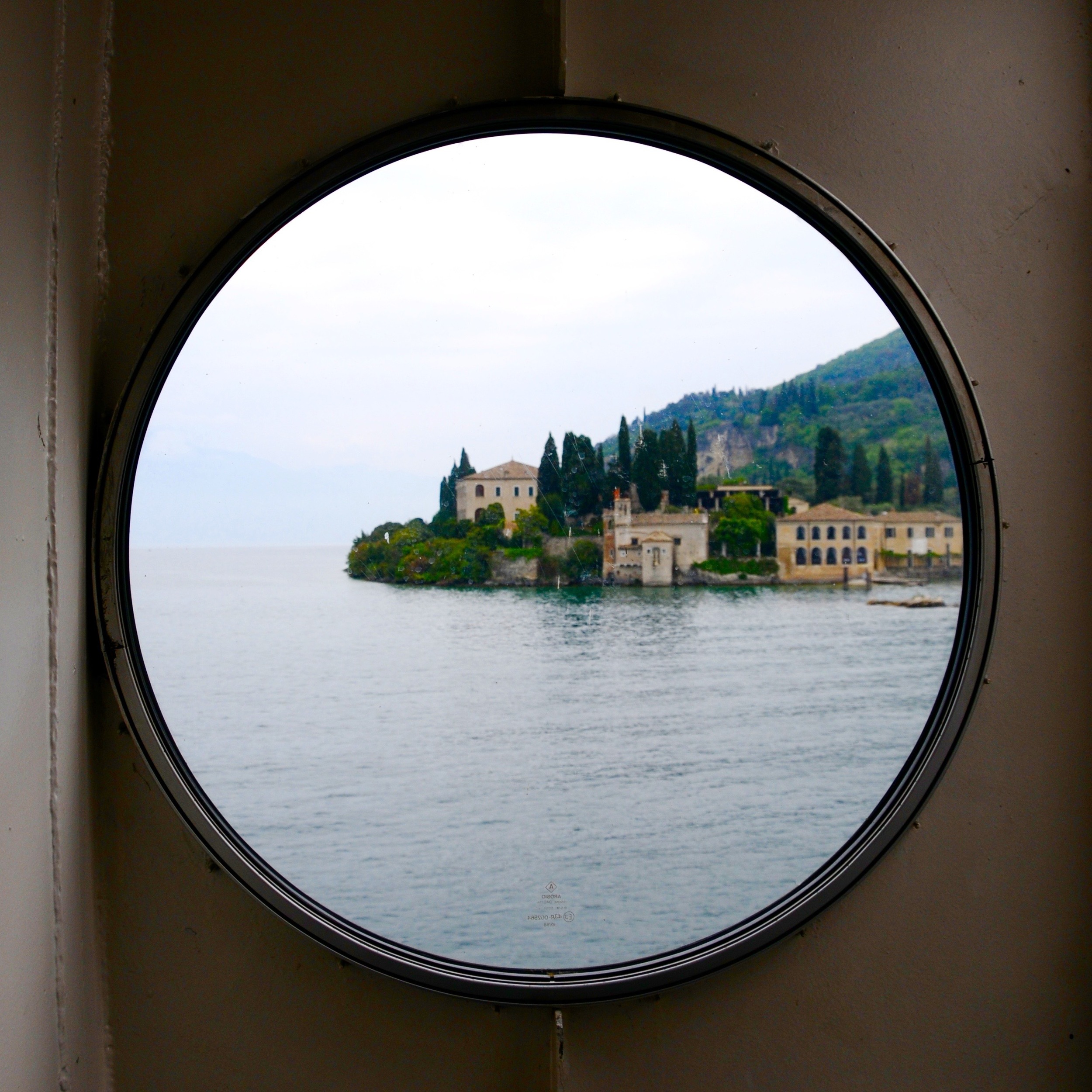
A view from the boat. The lake is rimmed with classic Italian villas.

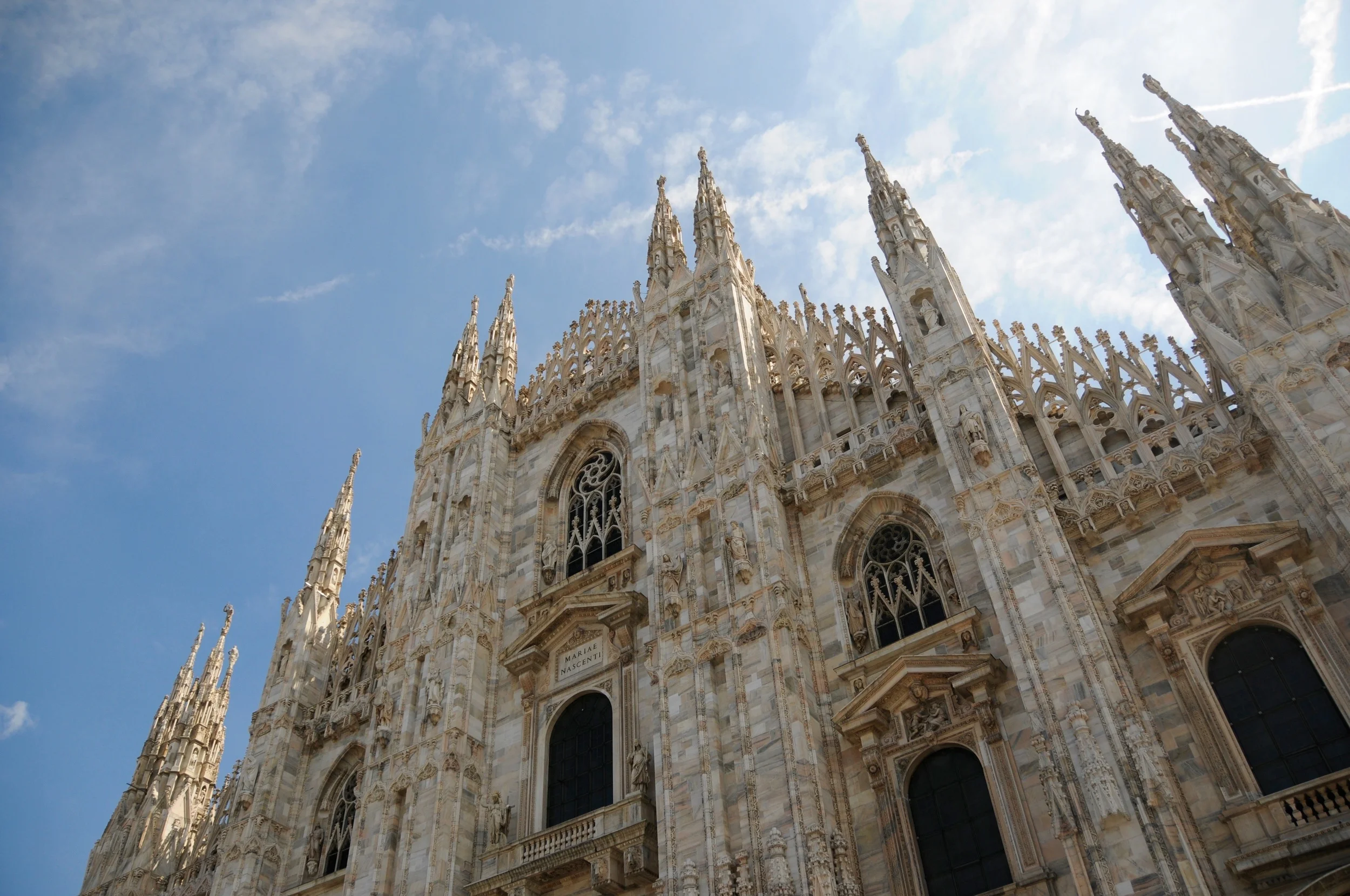
The Duomo Cathedral in Milan.

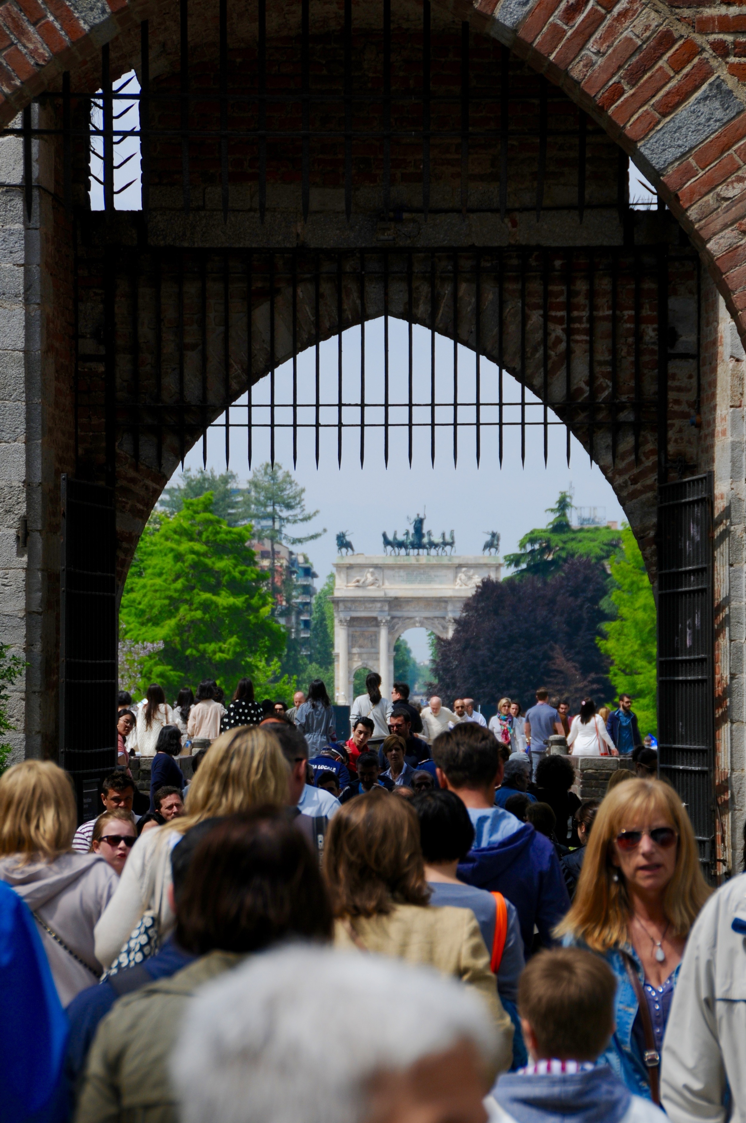
While in Milan we stopped by the 2015 World Expo. The theme for this year’s expo was sustainable food and feeding a growing human population. My mom and I spent 12 hours exploring all of the pavilions and I still wanted to see more by the time we went home. The brightly lit “tree” on the right was a massive sculpture that was built at the expo. If you happen to be in Milan before the expo ends in October, I highly recommend going.

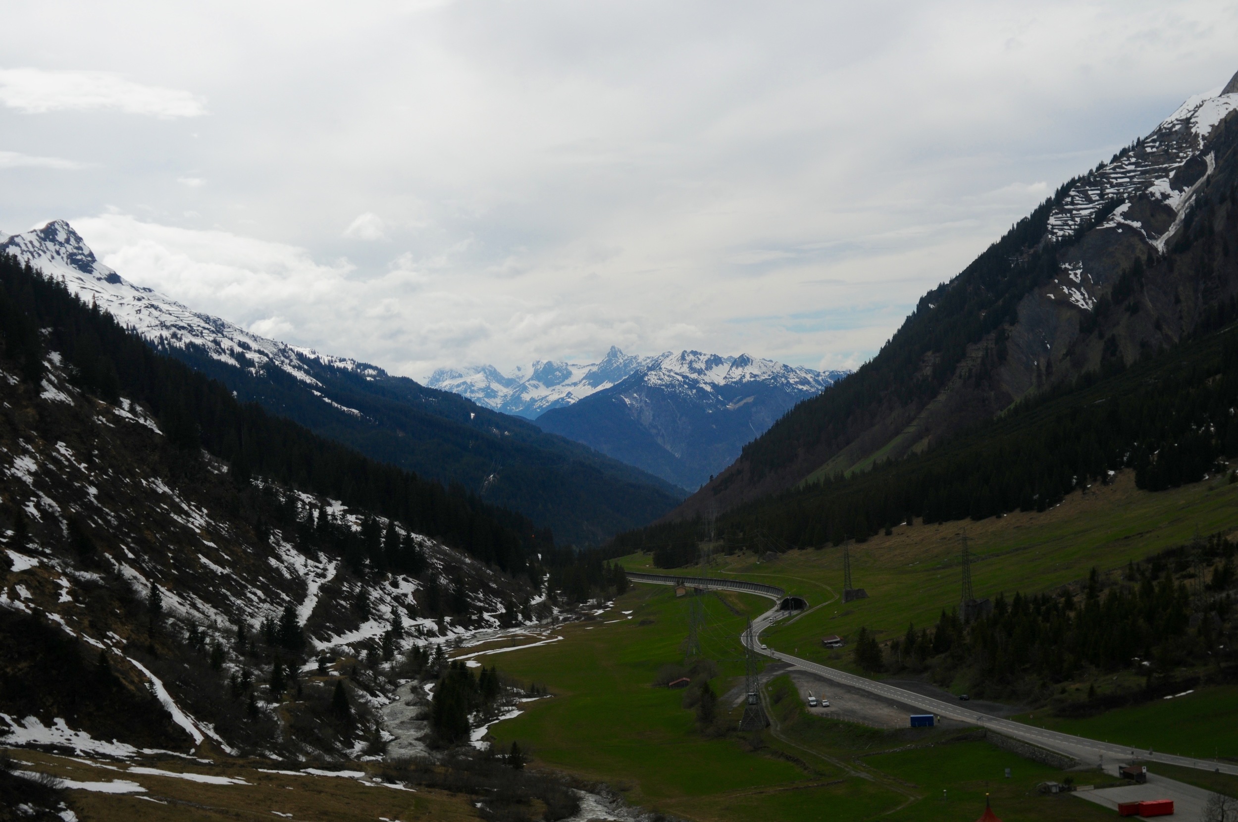
We decided to take the long way back from Milan to Germany by driving through Switzerland and Lichtenstein, I didn’t want to miss out on Swiss mountain roads and tunnels.

Just after crossing the border into Germany. The mountains in the distance are in Austria.

On my last full day in Europe my mom and I went on a nice long 15 mile hike up one of the mountains that surrounds Unterwössen. We walked right out the front door, up the street, and into the mountains.

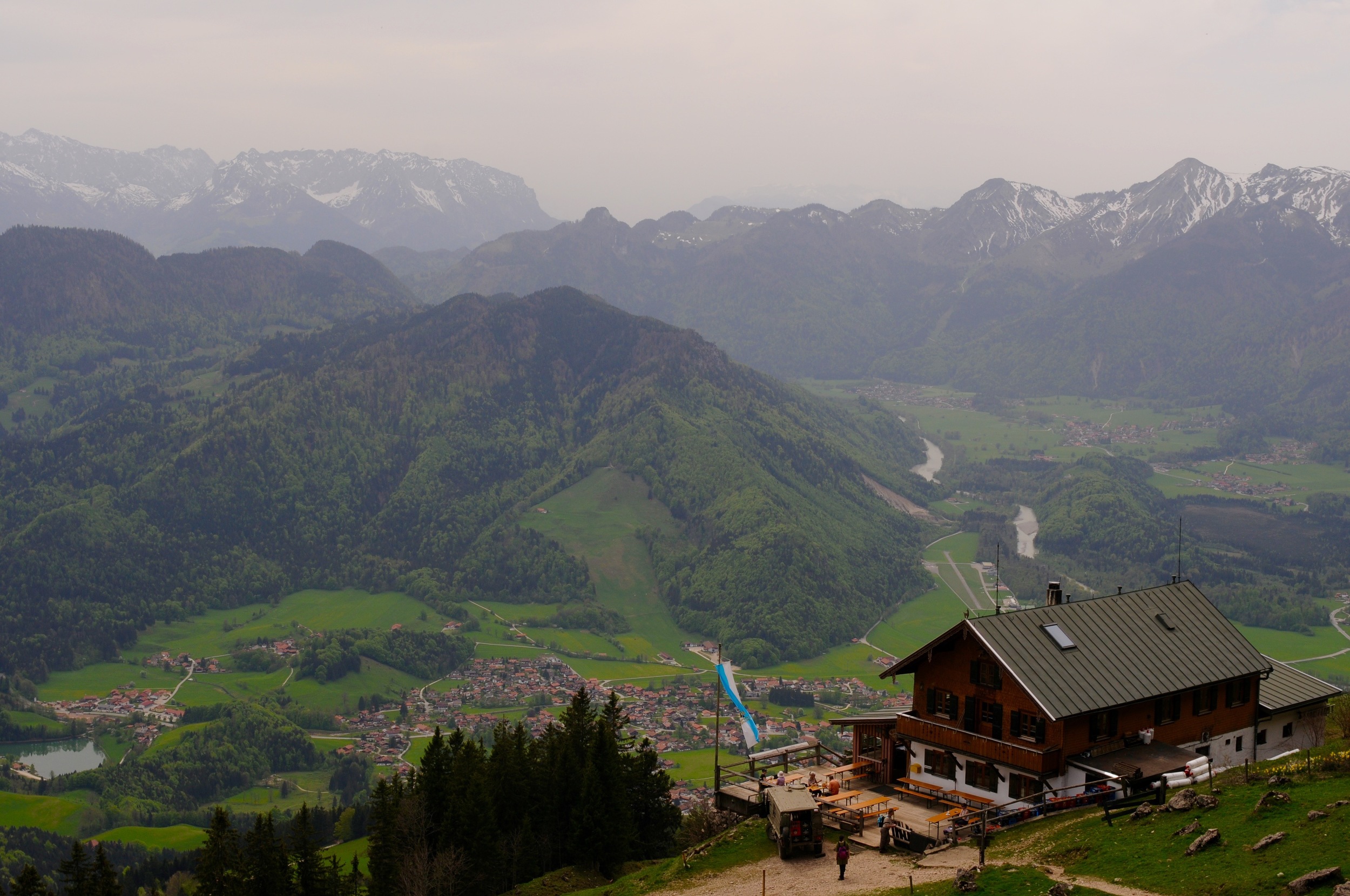
The view from the top of the mountain. Unterwössen is made up of all the tiny brown dots at the bottom of the valley there.

Hiking in the Alps is amazing because nearly every mountain has a restaurant at the top. Beer and Speck Brot make a great snack at the top of the mountain before the hike back down.

Panama 2015 by William Bryan

Panama City is a sprawling metropolis full of friendly people, good food and beautiful sites, there’s just one thing that the city lacks. After leaving the airport for our hotel in our rental car, my dad and I quickly learned that Apple Maps isn’t supported in Panama, and I hadn’t thought to download Google Maps before the trip. So without the little blue dot following along on my phone, I pointed my dad in the right direction by following along on the map according to where I thought we were. This ended up working just fine and after driving for 30 minutes we hadn’t had any mishaps and were almost at the hotel. I told my dad to take a u-turn because we needed to double back and turn on a street that we couldn’t take a left on before. 100 feet down the road we realized that all of the parked cars were facing the opposite direction, and the few cars that were on the road this late at night were headed right towards us. This was the first of three times that we would drive the wrong way down a one-way street. We never got close to being in an accident, but plenty of locals noticed, and pointed us in the right direction. The next day we stuck with walking. We headed from our hotel to the old town in Panama City. It felt like walking 80 years back in time along the water front.

Looking at the new city from the old town. Our hotel was on the far left of this picture – we walked about 10 miles total that day.

Walking along the water we saw that many of the boats weren’t floating, they were sitting in mud as if they never get used.

When we walked back to the city from the old town the tide had risen.

Our first glimpse of the old town. This part of this city has gone largely unchanged for decades.

The French consulate in Panama.

Parts of the old town felt like I was in Cuba, not Panama. Things haven’t changed much in 50 years.

The buildings are old and often run down, but that doesn’t stop many Panamanians from living here in the old part of town.

An advertisement for one of the several Panamanian beers that I tried while traveling. This was one of the better ones.

Traffic in Panama City is notoriously bad. Every guide book that we looked at told visitors not to be on the road between 3:30 and 7 p.m. We drove north of Panama City and stopped at the canal on our way to the Atlantic Ocean where we checked out Colón. Unfortunately the Panama Canal isn’t very photogenic when standing on the top floor of the visitor center surrounded by tourists, so no pictures from the engineering marvel.

The streets of Colón were bustling with hundreds of people, taxis, colorful busses and stray dogs.

An abandoned ship sits outside the northern locks of the Panama Canal. Other ships are coming and going in the distance.

There are probably just as many taxis as there are people in Panama. Even in Colón, which isn’t as touristy as Panama City, the ratio of taxis to people is probably 1:4. There are 11 in this photo alone. When you’re walking on the street they constantly remind you that they are there by honking their horn and asking if you want a ride.

As soon as we ventured off the main road in Colón there were a lot less cars.

We spent one day driving to the rain forest and hiking. We weren’t in Panama during the rainy season, but it was still filled with lush plants, growing on plants, growing on plants.

Rural restaurants and bars. Not many people live outside of Panama City, leaving these buildings pretty empty.

We had to drive surprisingly far from Panama City to find a beach. When I finally ran into the water I realized why there was no one in the ocean with me – jellyfish.

Patagonia 2014 by William Bryan

For winter break my family planned a vacation to Patagonia. A must visit for adventurers and photographers around the world. Seeing as I like to think of myself as both an adventurer and a photographer, I couldn’t have been more excited about my family’s vacation destination. We spent three days in Santiago, and eight days in Chilean Patagonia hiking portions of the “W.” After returning home my friends have asked me countless times what the best part was, or “How was your trip?” There is no way to describe Patagonia. You simply have to go yourself. It’s impossible to convey the vastness of the landscape through words or pictures, but I’ll try my best below.

Unfortunately, the best weather we had on the trip was while driving into the national park on our first day, and driving out on our last day. This made photographing a little difficult, especially when hail and sleet was pelting me in the back at 40 miles an hour. But I did my best to capture the beauty that Patagonia holds (GoPro’s can help with the extreme weather conditions).

Near a Penguin sanctuary on our first day in Patagonia.

A lone Gaucho presides over his flock of sheep. The lambs are extremely tasty if cooked just right…

Torres del Paine.

After arriving in Chile I realized that I would be in Patagonia during the southern hemisphere’s Summer Solstice, the longest day of the year. Being nearly as far south as you can go without traveling to Antarctica meant that the longest day of the year was VERY long. I decided that I wanted to try and capture the sunrise and sunset of the longest day of the year. I woke up at 4 a.m. to take this picture, and the picture below was captured around 10:30 p.m.

Hiking on Grey Glacier, which extends 25 kilometers further north (left, in the picture). Hiking around and exploring caves, crevasses and a massive field of ice is a great way to make you feel small, especially when vast mountain ranges are the backdrop.

On one of the last nights that I spent in Patagonia my sister, our guide and I were drinking wine and playing card and dice games until the sun set (which is a reasonably late time, especially if you have to wake up early the next morning to hike eight miles). A while after it got dark we decided to walk to the lake pictured above, and drink some whiskey out of a Nalgene along the way. But warm whiskey isn’t very good – especially when drinking it from a Nalgene. Another guide that we had been passing the time with, Jorge, had an idea about how we could cool down our whiskey. Icebergs. Because glaciers are constantly growing and shrinking with the seasons (and climate change), quite a few chunks break off and float across the lake. The smaller ones that have less mass below the water can get quite close to shore, making it possible to “harvest” them. Jorge donned his waders and ice axe and went to war with the nearest iceberg. He struggled about 30 feet out into the lake and started hacking at the ice until a chunk the size of a car tire fell off. He then dragged it ashore and broke it into smaller chunks that could fit in the Nalgene. Even bad whiskey in a plastic bottle can be made delicious if you add some glacial ice cubes to it.

During the summer constant winds of up to 50 miles an hour are not uncommon in Patagonia. This lends itself to some amazing  cloud formations.

It’s impossible to understand how vast and beautiful Patagonia is without visiting it yourself.

Oahu 2014 by William Bryan

Today was the first day of snow in Boston. I walked around the city browsing through stores looking for good Black Friday deals and got a little too cold on the walk home. Sitting here with a cup of tea looking out the window I caught myself thinking about my trip to Hawaii this summer.

My friend Kevin texted me: “Come visit me.” He lived in Hawaii and said it as a joke. He had told several of his friends from his freshman year in college to come visit him on his island in the middle of the Pacific. Most people responded with various reasons for why they couldn’t, but I said “OK.”

Later that day I asked my Dad if we could go to Hawaii later in the summer. We had been planning a Father-Son trip for August anyway, so after deciding to take the easy route (we were considering destinations like Mexico City, or Antigua, Guatemala), we booked flights to Oahu.

When I told Kevin that my Dad and I had just bought tickets to spend a week in Hawaii, he didn’t believe me. “Wait, really?” he asked. “Yes, really,” I assured him.

After landing in Waikiki at 11 p.m. I turned on my phone to a text from Kevin: Sunrise hike, I’m picking you up at 4:45.

Gulp, I wasn’t prepared for that. Even with the time difference helping me out I wasn’t excited to wake up that early to go for a hike. But hey, he was the local and knew what to do in Hawaii. That was half of the reason for coming to Hawaii anyway, I didn’t want to spend a week being a tourist going to the wrong beaches and eating shrimp at the wrong shrimp shack. I replied and we confirmed our plans.

The alarm rang at 4:00 and I slowly lumbered out of bed, trying to stay quiet so my Dad wouldn’t wake up in the other bed across the room. I mindlessly showered, pulled on some board shorts, and gnawed on a Cliff bar.

He picked me up outside of my hotel and we drove through the empty streets of Waikiki to his friends house. After picking her up we headed to McDonalds (the only place on the island that opens early enough) for some early morning grub. We ate our breakfast sandwiches as we drove to Makapu’u, watching the light in the sky grow brighter and brighter. I’m not sure about the other two, but I started to doubt our timing as the sky got brighter and brighter.

Needless to say, we made it in time:

The hike itself was relatively short, 20 minutes at most, so more of a sunrise walk, but I’m not complaining.

We made our way to the summit and then spotted a lighthouse below us that we wanted to explore as the sun rose.

The lighthouse.

We got to the lighthouse and discovered a fence separating us from our goal.

(We managed to get a little bit closer to the lighthouse).

My hiking companions.

After watching the sunrise, we hiked down a cliff and snorkeled in these tide pools.

This photo, and the next two below are from a hike up Diamond Head (not a sunrise hike, but still an early one) that I went on with my Dad later in the trip after I had recovered from the first Hawaiian hiking experience.

Thousands of houses are packed into the hills beyond the ridge of the inactive volcano.

Waikiki.

Two trees compete for space, somewhere on the North Shore.

Obligatory underwater photo.

Ireland 2013 by William Bryan

For the first semester of my freshman year at Northeastern, I was able to study abroad rather than go to the Northeastern campus in Boston. I could study in Australia, Costa Rica, Greece, England, or Ireland. I chose to go to Ireland. I chose Ireland for several reasons. First, there was no language barrier like there would have been with Costa Rica and Greece. Second, Ireland seemed relatively safe (at the time, there had been student riots in Greece because of unemployment). Third, I was going to be 17 at the start of the semester – the England and Costa Rica trips required that I be 18 upon arrival in the country. Finally, I’d never been to Ireland before, I had travelled to England and Australia before, and I wanted to travel somewhere new.

The program was split into two groups, science majors and business majors. Science majors attended the University College Dublin, and business students attended the Dublin Business School. At the time I was studying psychology, so I was enrolled at UCD. I lived in an off campus apartment, cooked my own meals, went grocery shopping, cleaned up after myself, and took a 45 minute bus ride to campus every morning. In short, I was 100% independent (except for money) for my first semester away from home.

I loved it. I met amazing people who were also part of my program, and went on weekend trips that really immersed me in Irish culture. We went to a farm and jumped into a bog, made bread and learned how to play Hurling. We traveled to the Cliffs of Moher, County Cork, Howth, the Aran Islands, Causey Farm, Northern Ireland, and County Sligo where we stayed in an eco lodge and surfed in a freezing rain.

For our first weekend in Ireland we took the Dublin Area Rapid Transit to a small seaside town, Howth. The town was quaint and beautiful, and framed by sweeping landscapes of the ocean. It was a great first place to visit outside of Dublin to give us an idea of how beautiful Ireland can be.

After having some time in the town of Howth, exploring a farmers market and the small harbor, we went on a coastal hike. This is one of the spectacular views that can be seen while on the trail.

Jumping into a bog at Causey Farm, extremely messy, but extremely fun. (I’m in the air).

Stunning, breathtaking, awe-inspiring, jaw-droppingly beautiful, terrifying; these are all apt descriptions of the Cliffs of Moher. I couldn’t have gotten any luckier with the weather when I went. No fog, no rain, some clouds but not too many; perfect for experiencing the terrifying heights of the Cliffs of Moher.

Looking along the coast, rolling green grass gives way to cliffs that are up to 700 feet high.

If you look really closely, you can see tiny specs on top of the cliffs. Those are people. That might give you an idea of how high these cliffs really are.

A view from above. It makes it seem like the water is so close to the grass. That couldn’t be more wrong.

More tiny specs (people) can be seen in the distance.

Members of my program “relaxing” on the edge. It was scary sitting on the edge myself, but even scarier watching my friends do it.

It’s hard to understand how green Ireland really is until you go there yourself.

A cow stands guard over a decaying farm house on the Aran Islands.

These cows are standing at the top of some very tall cliffs on the Aran Islands. They seemed to be more comfortable with heights than I was.

Standing on a cliff’s edge.

This is a view of the University College Dublin, where I took classes for the semester. Being from California, it was my first real experience of fall colors.

Dead leaves on flourishing ivy.

A view down a road on the grounds of Blarney Castle in County Cork.

India 2013 by William Bryan

In the spring of 2013 my graduating class of 14 traveled to India. We had several reasons for going to India. First, we had worked for months to get an interview with the 14th Dalai Lama, who is living in exile in Dharamsala. Second, my high school was founded by a Hindu Yogi (Baba Hari Dass) that also founded an orphanage called the Sri Ram Ashram in Haridwar; so my school has been connected with India from the very beginning. Lastly, who wouldn’t want to go to India for your senior year Spring Break?

Unfortunately, for some key moments of the trip (interviewing the Dalai Lama, exploring Dharamsala, and riding a rikshaw through Old Delhi) I was too in the moment to remember to take photographs, so what I have below is my attempt to include as many other parts of the trip where I did take photographs. Hopefully it will give you a snapshot of Indian culture, although it won’t compare to going there yourself.

 I looked out of our tour bus and stared up at these men that were sitting on top of a bus that was packed with people. They obviously don’t seem fazed about sitting precariously on top of a bus 15 feet in the air.

The colors in India are amazing.

There is a very good reason the Taj Mahal is one of the Seven Wonders of the World. In order to beat the crowds, my class arrived at the Taj Mahal at 7 a.m. This also proved to be the best possible time for photographing the beautiful monument. It may have been tough waking up that early, but it was definitely worth it for the view.

This photo was taken standing in front of the Taj Mahal looking towards the entrance gate. It’s a view that is photographed less, but is just as amazing.

Sunrise, facing a mosque on the eastern side of the Taj Mahal complex.

This was taken at the orphanage that my class visited while in India. I only had two days to get to know some of these kids, but that was enough time to learn that they are the most loving, outgoing, and thoughtful children I have ever met.

Like I said, the colors are amazing.

Every night thousands of people congregate at one portion of the Ganges river for Aarti, or, evening prayers. The ceremony is called Har Ki Pauri, and attending it is a pilgrimage for Hindus, who try and complete their evening prayers here at least once in their lifetimes. As evening falls priests perform a ceremony on the river banks while people send small boats made of leaves down the river. The boats hold a candle that represents their prayers. So many people, all showing so much devotion.

These men were part of one of a dozen or so remaining tribes that live on protected land. These tribes used to be nomadic, but over the years population growth has restricted any open land that is left in India, forcing these tribes to remain in one place. The only technology they had was a motorcycle (for getting to the nearest town for supplies), and a cell phone with a solar charger.

The Golden Temple, a holy site for Sikhs. Like the Taj Mahal, we arrived early in the morning to try and beat the crowd. Try is the operative word, look below.

The crowd at the Golden Temple. Thousands of Sikhs, with heads wrapped in colorful turbans, waited in line to enter the Golden Temple. Even early in the morning as the sun rose temperatures were flirting with the 90’s.This line had no organization, every five minutes guards at the front would let 20 or so people inside, starting a massive push  to move forward. If you were dedicated, you could make it to the front in 45 minutes. If you weren’t pushy, it could take two hours.